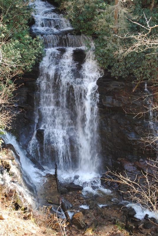
On our way back to Asheville we decided to look for a waterfall and after a short detour at a Mingus Mill, we found what we were looking for in Mingo Falls. On the guide map, we purchased at the ranger station for $1 it listed the hike as around a quarter-mile round trip and moderate in nature. Moderate being secret range code for straight up.
After a short but relatively exhausting hike, the falls are pretty awesome. Estimates on the height of the falls range from 120-180 feet depending on which you like better the guide map or the sign at the bottom of the hill.
These falls are on the reservation and the trailhead is relatively easy to find. It isn’t far from the main area at all. Definitely worth driving the 5-10 minutes out of your way to see.
Leaving Cherokee we opted to drive through Maggie Valley to get back to Asheville. On the way, we saw a small sign for Soco Falls and a small place to turn in. We did and when we got out we could hear the falls. (This rarely means the falls are close or even something you want to try and find.) The trailhead was poorly marked with the exception of a small note to stay on the trail. Solid advice but useless if you want to know what kind of trail, how far, etc. The $1 map – also useless – this waterfall obviously didn’t make the cut. We thought about not risking it. I mean – so far we’d seen one small sign and one small warning, not a lot to go on. So we started on the trail – what’s the worst that can happen? (Cue Deliverance music.)
The hike was short, relatively easy and the waterfall was really nice. Worth the effort to climb down what couldn’t have been more than 100-150 feet. Overall it wasn’t bad and really should have better signage. To the right is Mingo Falls and after the jump is a gallery of both falls.
Mingo Falls


Soco Falls


